

Cameras/Radar/SAT
 LWX NWS Radar
 BWI Visible Sat
CURRENT
Age
41 min | 14 Nov 20:53 UTC
KHGR 142053Z 29017G25KT 10SM SCT040 OVC047 07/M01 A2993 RMK AO2 PK WND 29026/2026 SLP150 60000 T00721006 53012
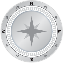
Wind
17 knots
Gusting
25 knots
Direction
290°
Oldest Newest
Previous Directions
KHGR AWOS
AWOS Phone Number
301-745-3497
AWOS Frequency
126.375 MHz
METAR
Age
41 min | 14 Nov 20:53 UTC
KHGR 142053Z 29017G25KT 10SM SCT040 OVC047 07/M01 A2993 RMK AO2 PK WND 29026/2026 SLP150 60000 T00721006 53012
Wind
from the WNW (290 degrees) at 20 MPH (17 KT) gusting to 29 MPH (25 KT):0
Sky Conditions
overcast
Visibility
10 mile(s):0
Altimeter
29.93 in
Temp
45 F (7 C)
Dew Point
30 F (-1 C)
FORECAST
Date
14 Nov 18:22 UTC
TAF KMRB 141720Z 1418/1518 30014G28KT P6SM BKN040
FM142200 30013G22KT P6SM BKN040
FM150900 29008G16KT P6SM BKN035
FM151300 31011G18KT P6SM BKN029
FM151700 32012G20KT P6SM BKN035
Aviation - GA NEWS
- ForeFlight launches Voyager app for Apple Vision Pro - February 5th, 2024
- Pilot and passenger still missing after crash - February 5th, 2024
- Picture of the Day: You never know what treasure you may find - February 4th, 2024
- Human Factors: A watered-down test flight - February 4th, 2024
