

Cameras/Radar/SAT
 DIX NWS Radar
 ALB Visible Sat
CURRENT
Age
6 min | 11 Nov 18:10 UTC
KMMU 111810Z AUTO 22007KT 10SM SCT055 17/03 A2989 RMK AO2
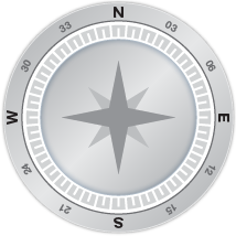
Wind
7 knots
Gusting
0 knots
Direction
220°
Oldest Newest
Previous Directions
KMMU AWOS
AWOS Phone Number
973-290-0135
AWOS Frequency
METAR
Age
31 min | 11 Nov 17:45 UTC
KMMU 111745Z 28009G15KT 10SM SCT055 17/05 A2990
Wind
from the W (280 degrees) at 10 MPH (9 KT) gusting to 17 MPH (15 KT):0
Sky Conditions
partly cloudy
Visibility
10 mile(s):0
Altimeter
29.90 in
Temp
63 F (17 C)
Dew Point
41 F (5 C)
FORECAST
Date
11 Nov 18:24 UTC
TAF KEWR 111721Z 1118/1224 27007KT P6SM SCT250
FM112200 23005KT P6SM BKN250
FM120000 VRB04KT P6SM FEW070 BKN250
FM120800 06006KT P6SM SCT070 BKN150
FM121300 08009KT P6SM OVC070 PROB30 1213/1216 -SHRA SCT025 BKN040
FM121600 08011G18KT P6SM -SHRA BKN025 OVC040
FM121900 06010G17KT 4SM SHRA BR OVC025
FM122200 02010KT 5SM -SHRA BR BKN025 OVC040
Aviation - GA NEWS
- ForeFlight launches Voyager app for Apple Vision Pro - February 5th, 2024
- Pilot and passenger still missing after crash - February 5th, 2024
- Picture of the Day: You never know what treasure you may find - February 4th, 2024
- Human Factors: A watered-down test flight - February 4th, 2024
